Atop Walden Ridge at 1,703 feet
Heavy Duty Towing in Signal Mountain, TN
Steep grades, a river view 1,000 feet down and two-lane roads across the plateau.
- Dispatch answers 24/7
- Honest arrival estimate on the call
- Written invoice estimate before the hook-up
Recovery on a Mountain Road
Heavy Duty Towing on Signal Mountain is a grade problem more than a traffic problem. The town, with 8,852 people at the 2020 census, sits atop the south end of Walden Ridge at 1,703 feet, and its southern edge overlooks the Tennessee River about 1,000 feet below. The Tennessee Legislature passed the bill chartering the town on April 4, 1919. A loaded truck with failing brakes or a bus with an overheated engine on this mountain needs the right equipment and the right plan. Call (423) 387-0740.
US-127 up the mountain
U.S. Route 127, also called Ridgeway Avenue in town, is the main road. It runs about 8 miles south to downtown Chattanooga and about 21 miles north over Walden Ridge to Dunlap. In Chattanooga it follows Signal Mountain Road as a six-lane undivided highway, then climbs onto the Cumberland Plateau as a two-lane road through Walden and Fairmount. Wikipedia notes SR 27 splits off west along Suck Creek Road about 1.5 miles in. Tell us whether you are on US-127 or Suck Creek Road when you call, and which side of the town line.
What goes wrong on a climb
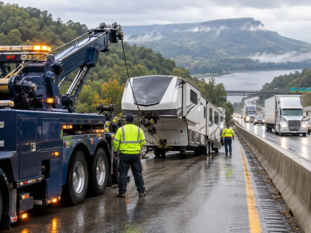
A heavy wrecker and a rotator can both work a slope, but the plan changes with the grade. If a truck is climbing and the engine quits, we need to chock the wheels and keep it from rolling. If a truck is descending, the main question is whether it has brakes. Moving trucks, delivery box trucks, tree-service trucks, motorcoaches and RVs each recover differently on a mountain road. Give us the unit type, the weight class and the grade as you see it.
History that explains the roads
Native Americans used Signal Point to send fire and smoke signals across the Tennessee Valley, and the Union Army used it as a communications station during the Civil War. Health epidemics in Chattanooga in 1873 and 1878 pushed wealthy families toward the mountain. Charles E. James bought 4,400 acres in the Signal Point area in the early 20th century, and 12 miles of streetcar track linking Chattanooga to the mountain were completed in 1913.
Destinations that bring large vehicles
Signal Point is part of Chickamauga and Chattanooga National Military Park. The Cumberland Trail, Mabbitt Springs and Rainbow Lake draw visitors, and the town also has the Signal Mountain Playhouse and the MACC arts center. The 1973 Spaceship House sits just south of the town line on Route 127. Tour buses, charter coaches and RVs make the climb for these stops, and a breakdown on a narrow road can stop everything behind it.
Beyond the town: the plateau
North of town, US-127 crosses the Cumberland Plateau on a two-lane road. Wikipedia notes sharp switchbacks and narrow sections farther north on the same highway, in the Fentress County area. If you break down on the plateau, give us a landmark such as Walden, Fairmount or the Suck Creek Road junction.
Reading the mountain correctly
The town borders Chattanooga to the south, Walden to the northeast and the unincorporated community of Fairmount to the north. Those names are useful landmarks when you call. A driver who says "just past Fairmount, northbound on US-127" gives us a lot more to work with than "on the mountain."
Before you call
- Which road: Ridgeway Avenue, Signal Mountain Road or Suck Creek Road
- Uphill or downhill, and the nearest cross street or landmark
- Unit type and weight class
- Loaded or empty, and the cargo
- What is wrong and who pays
The dispatcher gives an honest arrival estimate on the call. Call (423) 387-0740 or
.Signal Mountain Facts
- Mountain town. Signal Mountain sits atop the south end of Walden Ridge at 1,703 feet, and its southern edge overlooks the Tennessee River about 1,000 feet below.
- US-127. US-127 (Ridgeway Avenue) runs about 8 miles south to downtown Chattanooga and about 21 miles north over Walden Ridge to Dunlap.
- Suck Creek Road. SR 27 splits off US-127 west along Suck Creek Road about 1.5 miles into the Signal Mountain Road section.
- Streetcar line. Twelve miles of streetcar track connecting Chattanooga to the mountain were completed in 1913; the town was chartered April 4, 1919.
Our Services in Signal Mountain, TN
Signal Mountain Questions
Can you recover a truck on a steep Signal Mountain grade?
Yes. Tell us which road, uphill or downhill, and whether the brakes work. The dispatcher plans around the grade and gives an honest arrival estimate.
My RV overheated on US-127. Can you tow it?
Yes. Give us the RV length, the weight class if you know it and where you are stopped. Pull as far off the road as is safe.
Do you cover Suck Creek Road?
Yes. Call (423) 387-0740 and tell us which direction you are traveling and the nearest landmark.
Free Estimates in Signal Mountain, TN
Heavy towing on Signal Mountain and Walden Ridge, 24/7. Call (423) 387-0740.
Heavy Duty Towing Near Signal Mountain
- Heavy Duty Towing in Chattanooga, TN
- Heavy Duty Towing in East Ridge, TN
- Heavy Duty Towing in Red Bank, TN
- Heavy Duty Towing in Soddy-Daisy, TN
- Heavy Duty Towing in Collegedale, TN
- Heavy Duty Towing in Ooltewah, TN
- Heavy Duty Towing in Cleveland, TN
- Heavy Duty Towing in Dayton, TN
- Heavy Duty Towing in Jasper, TN
- Heavy Duty Towing in Kimball, TN
- Heavy Duty Towing in South Pittsburg, TN
- Heavy Duty Towing in Monteagle, TN
- Heavy Duty Towing in Fort Oglethorpe, GA
- Heavy Duty Towing in Ringgold, GA
- Heavy Duty Towing in Dalton, GA
- Heavy Duty Towing in Rossville, GA
- Heavy Duty Towing in Trenton, GA
- Heavy Duty Towing in Lookout Mountain, TN
- Heavy Duty Towing in Calhoun, GA